
grand rapids riverfront
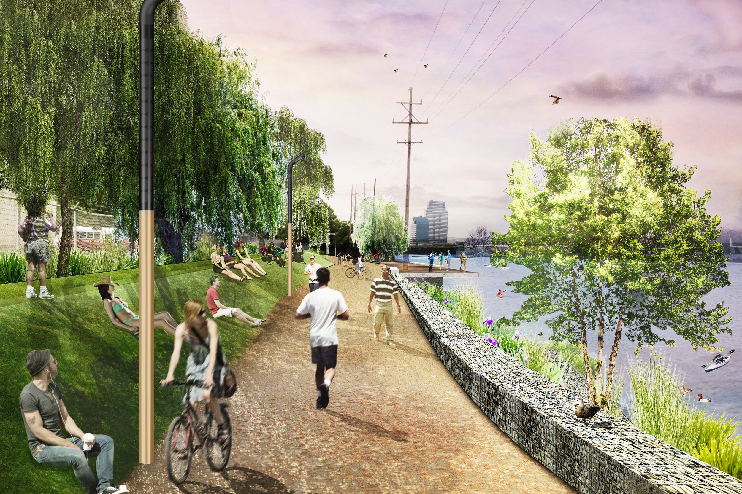
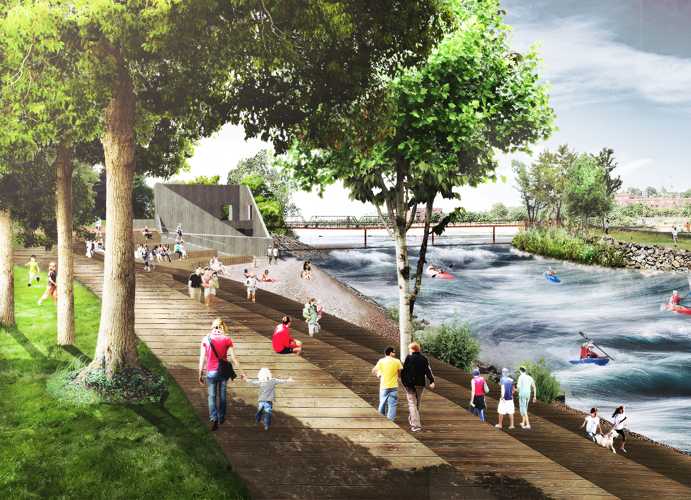
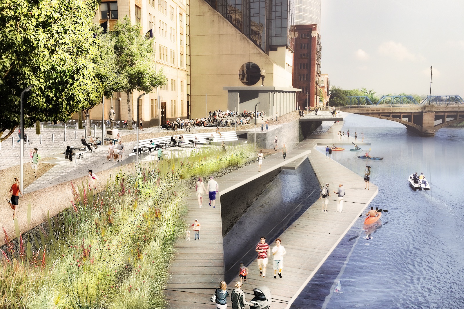
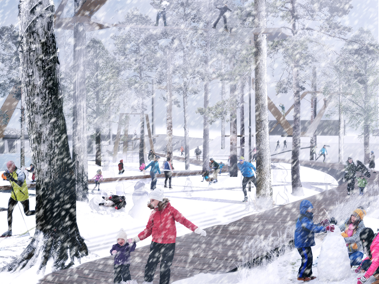
This multi-disciplinary, multi-site project focuses on reconnecting the Grand River with the community of Grand Rapids, creating new recreational opportunities along the water and a vision for a more energetic and resilient downtown. The overall goal was to provide a range of connected, unique experiences while strengthening the City’s identity as progressive, healthy, and vibrant. The resulting master plan addresses the Grand River’s outmoded flood protection system and casts a vision for accessible public amenities aimed, not only at protecting the city from an increasing flood risk, but also providing recreation, including floating boardwalks, kayak docks, yoga decks, biking trails, and wildlife habitat.
Stoss identified 16 sites at over 70 acres along 6 miles of the Grand River, each site tapping into larger issues of flood protection, public access, and ecology, bringing new interest, development, and activity to the city’s river. The project involved an extensive public process with the community, various stakeholders, individual property owners, and local, state, and federal agencies, including the US EPA, US Department of Agriculture, FEMA, and Housing and Urban Development, as well as the Michigan Department of Natural Resources, Michigan Department of Environmental Quality, and the Grand Rapids Departments of Planning, Environmental Services, and Energy and Sustainability.
GR Forward is a plan but also a call to action that organizes the actions of local leaders, private and non-profit organizations, residents and businesses toward a shared vision for Downtown, the River and local schools.
Timeline
2014—2015
Status
Completed
Size
9 miles
client
Downtown Grand Rapids
location
Grand Rapids, Michigan
TEAM
Stoss
Interface Studio

The River Corridor
The River corridor presents the opportunity to offer a range of connected, unique experiences around outdoor adventures not usually found within urban centers. Through a series of promenades, floating river walks, and trails, the plan re-establish the emotional and physical connections between Downtown and the River that Grand Rapids was built upon. Critical east-west streets are reconsidered not simply as traffic arteries, but cultural corridors that extend the presence of the River into the city and connect neighborhoods to the heart of Grand Rapids. through a series of promenades, floating river walks, and trails.


Coldbrook Edge
The plan re-positions the Grand River as the center of the city’s social and economic life, and reconnects critical east-west corridors into the city, it also was a catalyst for a preliminary built project that provided a resiliency upgrade. A section, Coldbrook Edge, was assessed and the Stoss team designed a series of tiered gabion walls that provide flood protection as well as critical access to an existing seawall. Over top, a viewing deck was constructed to provide an overlook to the river.

